We’ve
always been intrigued by the diversity of the geology and ecosystems protected
by our national parks. But sometimes you come across something so unique, you just
scratch your head and ask why. Why this? Why here? Just why?
When
I think of sand dunes, it’s the Oregon coast that comes to mind, certainly not
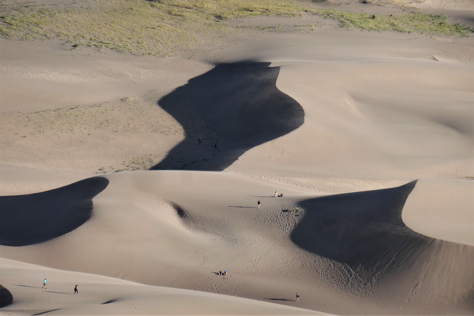
Colorado! Why is there a 30-mile long dune field, with the tallest sand dunes in
North America (750 feet!) in the middle of Colorado?? Well, it’s called the
“Magnificent Coincidence”. Most of the sand comes from erosion in the San Juan
Mountains 65 miles to the north. Prevailing southwesterly winds carried the
sand to a shallow bend at the base of the Sangre de Cristo Mountains. Near the
mountains the wind patterns become more complex, blowing the sand back onto
itself and forming the dunes. Two seasonal streams wrap around the margins of
the dunes depositing sand, which is picked up by the wind and redeposited in
the dunes. Pretty wild that just the right circumstances of wind, water and
earth conspired to create such a natural wonder!
 |
| The Great Sand Dunes. |
What
was really interesting is that the huge dune field comprises only 11% of a
330-square-mile deposit of sand! The majority is in the sand sheet or
grasslands, where plants have anchored the sand. The remaining 36% is a salt-encrusted
plain or sabkha (new word 😊). This area has the wetlands, including
the San Luis Lakes Wildlife Area where we camped. Where the water table is high, the water repeatedly rises to the surface and then evaporates leaving a white
crust of mineral deposits.
 |
| The campground is in the sabkha, the dune field is 15 miles away with grasslands between. |
One
thing we loved about Great Sand Dunes, it’s both a national park and a preserve
so most of the trails are dog friendly! Leashed pets are allowed in the day use
area of the park including the play area of the dunes and areas designated as
national preserve. The only place they can’t go is the backcountry areas of the
national park. Riley is a little ambivalent about this rule change, while he
likes to come with us, instead of a leisurely nap and a yummy marrow bone while we hike, he
gets drug along. Lol.
Our
first day in the park, Riley had it easy. We stopped in the Dune play area, but
it was warm and sunny and Riley was most interested in finding some cool sand
in the shade. 😊
 |
| The dune play area. You can rent sand sleds and sandboards too. |
 |
| Riley much preferred the shady bits. Lol. |
Then
we drove the 4-WD Medano Pass Primitive Road as far as the Sand Pit. We found a
picnic area where we could walk to a section of the Medano Creek that still had
a little water. Then we hiked up onto the dunes. Since there was no one else around, Riley got
to go off-leash and do his crazy dog runabout.
 |
Looking regal.
But only for a quick minute. Lol. |
 |
| Just a little bit of water left in Medano Creek. |
 |
| Not so regal looking chasing Daddy up the dunes. |
 |
| Patterns in the sand. |
We
were happy with how well the Acadia handled the soft sand. We opted not to go
all the way to Medano Pass, since we didn’t have the ground clearance for rocky
stretches. It’s easier to get stuck than you think, on our way to the park a
young guy flagged us down and asked for help. He’d driven just a little way off
the paved road and gotten stuck. We were able to give him a tow out – yay for
4WD.
 |
| Props to the Acadia and 4WD. |
We
did the Mosca Pass Trail on Saturday morning with Riley. You’d think by now I
would have figured out that any trail with the word “Pass” in its name is going
to go straight up. Lol. The trail started off through the aspens, crossed Mosca
Creek, and then quickly climbed into pine forest and further up along a rocky
ridge. The whole trail is 7-miles roundtrip, but Riley insisted on a much more
manageable 2-mile hike. I didn’t argue (at all). 😊
 |
| A gentle path along the creek is what I was expecting. |
 |
| Should have known better with "Pass" in the trail name. Lol. |
 |
| Riley gets a drink. |
 |
Anyone know what this is?
It's white fuzzy filaments glowed in the sunlight. |
 |
| Almost done, you can see the dunes in the background. |
After
lunch back at the coach and a little time to relax, Rog and I headed back into
the park for the hike I’d most been looking forward to. The climb to the top of
High Dune is about 2.5 miles roundtrip. There is no trail, you just follow the
dunes choosing a path that looks doable. Now, let’s talk for a minute about the
dubious wisdom of saving the most strenuous hike on the dunes for what turned
out to be the windiest day of our stay. And what idiot would deliberately
choose late afternoon, by far the windiest time of day. Well, an idiot who
wanted sunset pictures from High Dune. (Sheepishly raises hand, that would be
me.) We trudged across the dune play area; at the base it was breezy but
nothing to worry about. HOWEVER, the higher we got the stronger the wind.
 |
| This is where we're headed, 650' up to High Dune. |
 |
| Tracks in the soft sand. |
 |
| About half way there... still smiling. :) |
 |
| We've come a long way baby... but we're not there yet! |
 |
| A pause for some shadow play. |
Slogging
through deep, soft sand is no picnic. On the steep dunes it’s one foot forward,
slide six inches back. By the time we were nearing the top, the wind was
howling so fiercely it was difficult to stand upright! The sand was blowing so
hard you could hardly see, and it felt like every bit of exposed skin was being
flayed. If this is nature’s exfoliant, I’ll skip the spa
treatment thank you very much. I tried taking pictures with my back to the
wind, but there was so much grit and sand blowing my camera started to
malfunction. Arrrrrgh. It was so crazy Rog had to hold onto me so I could stand
upright to get a few shots. In the short
breaks between gale force gusts, we took what pictures we could and decided our
original plan to hang out at the top of High Dune until sunset was clearly insane.
 |
| So much sand in the air it actually made the photo look out of focus! |
 |
| Rog's pano from High Dune. |
 |
| Selfie at the top! |
 |
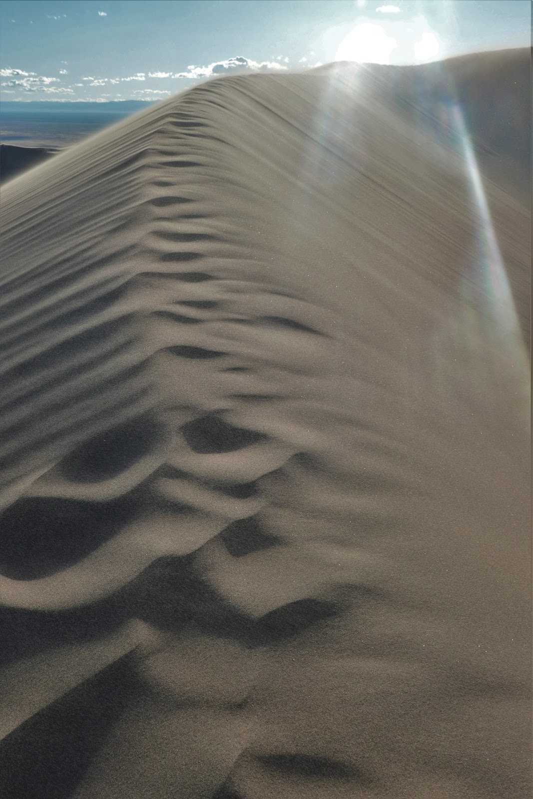
| High Dune ridge-line. |
 |
| The dune field stretches out for 30 miles! |
 |
| Can you see the sand blowing? |
 |
| The wind made the dunes look fuzzy. |
The
trip down was a lot quicker and a lot more fun. Just pick a steep dune and
start down, the sand would slide around you like water. My shoes filled with so
much sand there wasn’t room for my feet! We had to stop more than once to dump
them out. Back at the car, we shook out as much sand as we could, but no doubt
we’ll be finding sand and grit in unwelcome places for some time to come. Lol.
 |
| It felt like I brought half the dune with me! |
 |
Back down at the bottom and we're getting some evening shadows.
The air is a lot calmer here! |
We
found a good spot to watch the sunset and were happy to be off the High Dune.
It was an adventure! But next time we go in the morning when the winds are
calmer!!
 |
| Evening light over the dunes. |
 |
| Final shot of the dunes and the Sangre de Cristo mountains. |
Our
next destination is a boondocking spot in the Carson National Forest about 30
miles from Taos, NM. Unfortunately, the winds we experienced on High Dune
weren’t an anomaly. The next three days are calling for sustained winds of
20-30 mph with gusts up to 40. We’ll try for an early start, so we can be off
the road before things get really hairy in the afternoon. Yep, learned that
lesson. Lol.