Friday, February 24, 2017

Terlingua and the Red Buffalo Hunt

The town of Terlingua is a bit of a desert oddity. Once a bustling mining town in the 1930’s it was abandoned and fell to ruin when the mines went bust in the late 1940’s. Then in the 60’s the area was repopulated by “modern pioneers” (naturalists, river guides, musicians and artists).  They repurposed some of the ruined buildings and started up a community garden and co-op. The roof was gone from the old theater, so they turned it into an open-air venue for parties, concerts and theatrical productions (hence the name “Starlight Theater”). In the 1990's, the theater got a face lift and now it’s a $$$ restaurant.  The whole town has a fun, funky vibe and caters to both locals and tourists.

The Starlight Theater is a local favorite.


You can tell this is a town of artists. 

I wouldn't mind taking this one home. :)

Random car art.

The Saturday farmer’s market was small, but we managed to load up on local baked goods and foodstuffs including fresh eggs with the “born date” penciled on each one. Lol.  There are plenty of ruins still standing in the Terlingua ghost town and a cool old cemetery to explore. Of course free wifi and expresso was an even better draw. : )   

Lots of ruins scattered around town.

The old cemetery is still in use. 

We heard about a nearby trail leading to some old petroglyphs from some other campers. A few miles down a dirt road outside Terlingua brought us to a small parking area and a break in a fence marked as the National Park boundary. It was kinda fun sneaking in the back door. Lol.

Sneaking in the backdoor to Big Bend National Park. :)

The scenery here was different from what we’ve seen so far – sheer cliffs that shed ginormous boulders that have been carved by wind and rain, alkaline flats where nothing grows, black volcanic grit littered with flat crystals that looked like broken glass, and the occasional ancient graffiti. We ran into another couple and stood chatting for nearly an hour – we ended up having lots in common (early retirement, politics, travels), they’ve just been at it longer! It’s fun to find like-minded folks on the road.  Another couple we ran into were hunting for a pictograph of a red buffalo. They showed us a picture, and we hunted around for awhile, but without any specific information on its location none of us had any luck. We hadn’t planned for a long hike, so we opted to plan a return visit. 

Boulders fallen from the cliff face.

I did say ginormous boulders!

Alkaline flats.

Volcanic grit littered with crystal shards.

Petroglyph etched into the rock.

Great view of the Chisos Mountains too!

Sunday was rainy and we hung out at the RV, catching an afternoon break in the weather just long enough to get in our walkies. Monday was clean and sunny and mid-70’s. Perfect for buffalo hunting. Lol. We headed back to Terlingua and after a frustrating time trying to use the local wifi (I will be sooooo glad to get back to the land of Verizon LTE!) we headed for the back door of Big Bend National Park again.

This time we did a serious hunt for the red buffalo. We hiked further. We climbed higher. We searched longer. We looked on, under, and between hundreds of boulders. We actually found several petroglyphs and some 1902 graffiti. We also found quite a few boulders that had been used to grind grain, the perfectly round grinding holes were still filled with water from Sunday’s rain. But we never did find the red buffalo. Oh well, the hunt was great fun.

We searched high...

... and low.

We found more petroglphys... 

... and holes for grinding grain...

... but no Red Buffalo. And it felt like we checked every one of these boulders! Lol. 

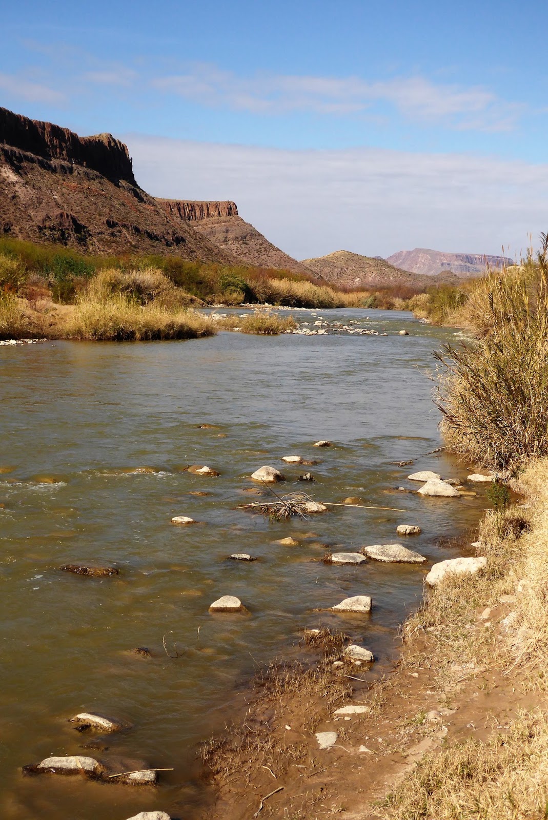
We’ve decided it’s getting time to move on from our lovely spot in the state park. We will spend a few more days here - we still want to float the Rio Grande and Rog is going to do some more of the Epic mountain bike trail – but Thursday, 2/23, we heading out. We've been shut out twice trying to get a boondock spot in the national park, hopefully the third time will be the charm. If not, we’ll try our luck at one of the campgrounds. Fingers crossed!

Wednesday, February 22, 2017

Epic Biking and the Mule Throws a Shoe

On Thursday, 2/16, Rog joined the hordes attending the mountain bike festival and rode a portion of the 60-mile Big Bend Ranch State Park “Epic” ride. He started at the East Contrabando Trailhead and road about 20 miles of the designated route. He had a great time and I always feel better knowing there are other riders on the trail. The portion he rode took him past several old ruins, in addition to ranching, there were several old cinnabar mines in the area. They extracted mercury which was in demand for explosives, especially during WWI. The last cinnabar mine closed in the early 70’s. 

The “Contrabando” moniker is a nod to the history of smuggling in this area. The rugged terrain was a favorite of the “contrabandistas” in the early 1900’s. Rum was brought over from Mexico during prohibition and candelillia wax was also smuggled in from Mexico in the 1930’s to avoid high tariffs. Hmmmm… will history repeat itself?

Ruins and teeny, tiny mountain bikers in the distance. 

"You are here."   Lol.

Interesting stuff to explore along the trail.

Rugged terrain is right.  The area is full of hidden ravines, perfect for contabandistas! Lol. 

On Friday we drove the CRV to the Sauceda Ranch Visitor’s Center. That sounds a lot easier than it actually is. The turnoff for Sauceda Ranch is about 40 miles away and then you drive another 27 miles of gravel road to get the visitor’s center. The draw for us was a whole slew of hiking trails. Usually our little CRV mule follows docilely behind the RV, hauls our toys, and does the occasional grocery run, but here it gets to be the star of the show. Lol. Given the distances and uncertain roads, we'd miss a lot without it.

The first hike we did was Ojito Adentro, a short trail that lead to a spring and seasonal waterfall. You can tell where the larger springs are by the groves of cottonwood trees tucked into the ravines. Interestingly enough, winter is the dry season here so while we found a lovely pool, there was no waterfall.

Quite the change of pace from the dry, scrubby desert!

The trail is hidden behind this giant snag...

... and we had to squeeze between boulders ...


... but the pool at the end was well worth it!

The second hike we did was a 5-mile roundtrip trek to the Fresno Canyon Rim Overlook. This was a great hike that wound up and down and around desert mesas with a gorgeous payoff – it ended at a 700-foot cliff overlooking Fresno Canyon with great views of the flatirons of the Solitario. The Solitario is one of the signature landscape features of the park, almost 10 miles across and nearly symmetrical, it is a collapsed and eroded volcanic dome. The southwest rim is made up of distinctive inverted V-shaped rocks called flatirons.


Trail marker pointing towards the flatirons.

Up one hill and...

... down another. Lol.

Great views all along the trail.

Solitario and flatirons from the Fresno Overlook.

Not very hospitable, but still beautiful.

Close up of the flatirons.

Still happy campers!

The road to/from the Fresno Canyon trailhead was sketchy, while it was rated for high clearance 2WD, some spots were washed out and pretty rough. The CRV was hanging in there, at least until the poor mule threw a shoe. We abandoned our plan to do another short hike when the tire pressure idiot light came on. Rog checked and everything looked ok, maybe the sensor just got rattled and damaged. (Hey, we could hope!)  We drive a few more miles and he checks again. Dang. Rear passenger tire is nearly flat. He puts on the spare and we hobble towards Presidio, the closest town. As soon as I get any cell service I start hunting for a tire place and manage to locate one, but by now it’s 5pm on Friday and they are rolling up the sidewalks. The repair place agrees to wait for us for which we were extremely grateful. We pull in around 5:30pm and luckily the tire was repairable, so 15 minutes and $20 later we are good to go.  Yeah!

Well, maybe not such a happy camper at the moment. Poor little mule threw a shoe.

Our plans for Saturday include a visit to the Terlingua ghost town and a farmer’s market. Here's hoping the mule doesn't go lame again. :)


Sunday, February 19, 2017

A Lost Oasis, Crystal Hill, and Jello Plans Firming Up

Monday, 2/13, we went in search of a desert waterfall. The Rancherias Canyon hike was supposed to be 10 miles round-trip, terminating at a spring-fed waterfall deep in the desert. We started about 10am figuring that gave us plenty of time. However, the trail was difficult, scrambling over loose rock and boulders, through soft sand, and around desert seeps and small springs. The further we went, the less well marked the trail became. We lost sight of the trail markers and had to back-track several times. By 1pm we debated turning around but then we’d spot a trail marker and decide to go “just a little bit further”. Lol. However, by 2pm and at least 6 miles into the hike we still hadn’t found the falls. With no trail markers in sight, we weren’t sure if we hadn’t gone far enough or if the falls were dry (the area is in a drought) and we’d passed them. At any rate, our water was running low and we were mindful of the time so we headed back. I'm going with the lost oasis theory, since it couldn't have been us that was lost. Lol. It was a fun, challenging hike even without finding the falls, the scenery was fantastic and the geology of the area was fascinating. We talked to a park ranger later and we think we just hadn’t gone quite far enough. Although he did say the falls are more of trickle this time of year. Lol.  

We did find water in the dessert - just no waterfall. lol.

Spectacular scenery.

Desert Nettle is blooming.

So darn cute... but cuddly? Not so much. 

Rog on the Rancherias Canyon trail.

Natural "tanks" that hold water, at least some of the time. 

Bunny ears again! lol.

Blue skies and red rocks. 

No clearly marked trail here!

Don't see these in the PNW!  (And I'm ok with that. lol)

We also stopped at the Contrabando Creek Movie Set. Built in 1985, it has been used in nine different movies over the years. There’s just one building left, but the setting is definitely perfect for Westerns with the Rio Grande on one side and towering buttes and mesas on the other.

The cantina is the last building still standing on the movie set.  

The Rio Grande runs close to the set. 

You know how much I like rocks, so when Rog told me about a whole hillside covered is calcite crystals it was a safe bet I’d be making that hike. We set out Tuesday to do a 6-mile loop that included “Crystal Hill”. This hike was much easier, since it’s also a mountain bike trail and is clearly marked. We were walking around the perimeter of a big hill and all of sudden you round a corner and the trail cuts through an acre of glittering crystals. It’s amazing! The whole hillside is covered in loose crystals. I’m not sure how or why, but it’s a pretty clearly defined area. My self-imposed “no picking up rocks” rule is out the window. Lol. We are really having a blast looking at the different types of rocks and formations. We wish we knew more about geology – of course if we learn more, we might end up joining the ranks of rabid rock hounds. Just what we need, a hobby that involves carrying heavy rocks across miles of rugged terrain. Lol.

A whole hillside of crystals!

I confess. A few of these found their way into my pockets. Lol.

Wide open spaces.

Chisos mountains in the distance. 

Desert panorama.

After two days of hiking, we decided to make Wednesday a camp day. While there is plenty of maintenance and chores to keep us busy, we didn’t actually get much done. Some days it’s just nice just to sit and enjoy the view! Lol. To get in our steps we walked the Upper and Lower Madera campgrounds and hiked down the road a mile or so to some very interesting sandstone formations. They reminded us a lot of the hoodoos and slumps that we saw in the Badlands.  

Yeah, worth taking a day off to enjoy the view.

Cool colors in the stone....

... and awesome shapes too. 

Lupine blooming everywhere. 


The good news in our jello plans is we were able to get a reservation for Upper Madera over the weekend so it bridges the time from our existing stay to our reservation on the 20th. Whooohooo!  We are set until we decide to try again for a spot in the National Park.