Wednesday, May 8, 2019

Exploring Lee’s Ferry


Lee’s Ferry is a small campground situated between the Vermilion Cliffs and the Colorado River. All sites are first come/first served so we were happy to get a spot Thursday afternoon (4/25).  The campground completely fills up almost every day. No wonder, with gorgeous red cliffs as far as the eye can see and the cool green Colorado inviting you play.

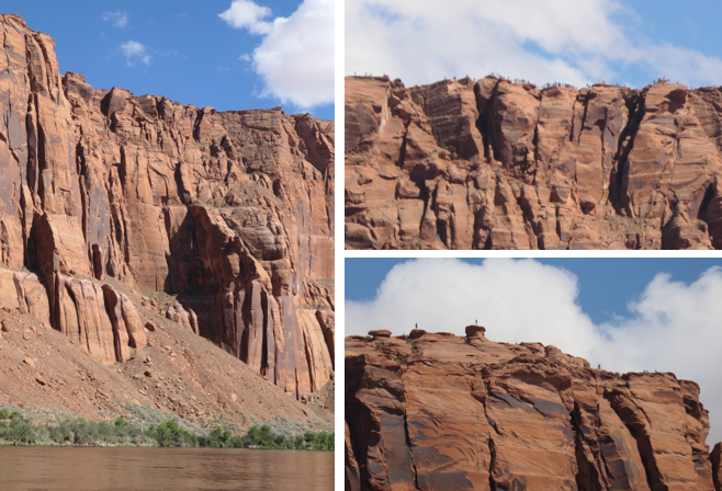
The beautiful Vermilion Cliffs.

A thunderstorm moves in.


The Colorado River was a short walk from the campground.

There are no hook-ups, so when the temps hit the high 80’s we grabbed our chairs and Riley and headed for the river. The water is released from the base of Glen Canyon Dam and it is COLD, averaging about 44°. Fun to splash around, and Riley enjoyed it, but that’s way too chilly for swimming.

Happy boys having fun at the river. 

The area also has an interesting history. Lee’s Ferry is the only place for hundreds of miles where the Colorado can be accessed and crossed from either side of the river. It has served as a military outpost for 19th-century settlements in Utah, a failed gold dredging effort, and more recently has figured prominently in the southwestern states water disputes. It's also marks the boundary between the Upper and Lower Basins of the Colorado River, and is a popular place for Glen Canyon and Grand Canyon rafting trips.

A Glen Canyon rafting tour approaches Lee's Ferry.

Remnants of a failed gold mining scheme.

Where did it get its name? From John Doyle Lee, who came to the crossing in 1870 with the goal of setting up a permanent ferry service for Mormon settlers heading south to Arizona. Lee had 18 wives and 56 children.  In 1857, along with other church leaders, Lee took part in the Mountain Meadows massacre.  A group of Mormons dressed as Indians and local Paiutes attacked a passing non-Mormon wagon train from Arkansas, killing over 120 men, women and children. The Mormons who orchestrated and participated in the massacre blamed it all on the Native Americans (of course). Eventually the truth came out, but only John Lee was ever tried in a court of law. He was convicted and executed in 1877. Although John Lee only ran the ferry for six years, the name stuck. Wow, named after a mass murderer, the stuff you learn by visiting our national parks!

Willows now grow along the banks where the ferry ran. 

Some of the old buildings were repurposed, others have fallen into ruin.

The Navajo Bridge was completed in 1929 and replaced the ferry. The original bridge was closed to vehicular traffic and opened only for pedestrian use once a second bridge, constructed to accommodate today's larger, heavier vehicles, was opened in 1995. We visited the dual spans on Friday and were thrilled to see a California Condor hanging out on the bridge. The park ranger said there are now over 90 Condors in the Vermilion Cliffs release area; each one is tagged and tracked.

Navajo Bridge, the 1929 original on the left is now a pedestrian bridge.


Looking down.

California Condor showing off on the bridge. You can see he's tagged #54.

View of the Colorado and Vermilion Cliffs from the bridge.

We also stopped along the road to get a closer look at these balanced rocks. They reminded me a lot of the formations we saw on the Toadstools hike. Many of these “mushrooms” were huge!

Balanced rocks.

That is one big mushroom! :)

We're always amazed that the huge boulders balanced at impossible angles don't just fall over!

Now I want to take you along on one of those hikes where you wonder just what you were thinking. Rog had read about the Cathedral Wash hike and there was some mumbled mention of rock scrambling and a 30’ pour over. I should have been paying more attention. Lol. The trailhead afforded fantastic views of the cliffs, so we're off to a great start.

Just wow.

The views from the trailhead were awesome!

The hike begins with a tunnel under the road. Notice there is mud on the ceiling. Remind me to be nowhere near here if there’s any chance of a flash flood! It’s a beautiful day and the wash is lovely. 

Mud on the ceiling, I don't want to imagine the raging torrent that deposited that!

Cathedral Wash starts out broad and open.


As you continue, the canyon walls get higher....

... and narrower. 

We hike about ¾ of mile in and stop. Yep, that’s a pour over. Yep, it’s at least a good 30’ down. I see no clear path. Well, dang that was a short hike. Rog is sure there’s a way down, the hike is an out-and-back totaling about 3 1/2 miles round trip. The turnaround point is where the wash empties out into the Colorado River.


The pour over. Do you see a way down? Me neither!

Rog starts hunting for a route down. I’m thinking no way; you have got to be kidding. Of course, my darling husband assures me that we don’t have to do this if it makes me uncomfortable. Uncomfortable? I’m so far out of comfort zone I can’t even see it anymore! But dang if I’ll wimp out without trying, so down we go. The first scramble down wasn’t quite as bad as it looked. But now where to?

Down we go!

We walk along a narrow ledge, duckwalking under the overhang and find another spot to scramble down a few more feet. After a few more descents over boulders and ledges, we make it to the floor of the wash! Yay me.

Now where to?

More scrambling to get to the next ledge.

Duckwalk and then another scramble down.

At the bottom of the pour over.
We made it (this far). Lol.

But we’re not home free yet. The rest of the hike is a leisurely walk between high canyon walls, with interesting rocks and geologic features punctuated by scary scrambles as the wash continues its descent to the Colorado.

More fun along the way.

Nothing boring about this hike!

A friendly local and more water carved canyon.

Finally, we hear rushing water and know the end is close. Ta-da! We made it - the lovely Colorado River!  I sat down on the bank to relax and took my shoes off to soak my tootsies in the cold water. Ahhhhh…was it worth it? You bet. But now we have to turn around and do it all again going uphill! Arrrrrrgh.  


The Colorado River marks the end of the trail.
Ahem. Actually it's just the mid-point, we still have to go back!

A break before the return trip.

A cool reward after a challenging hike. 

Our next stop is Kanab, UT where we'll see if we're lucky enough to win the lottery. No big money payout, but a chance to see the internationally famous Wave. Cross your fingers!

Friday, May 3, 2019

Floating and Boating in Glen Canyon


As some of you know, we have big plans for 2020 – we’ve booked a 15-day float trip through the Grand Canyon! The Colorado River flows from Glen Canyon into the Grand Canyon at Lee’s Ferry. We’re already excited about going and when we saw an opportunity to do the section of Glen Canyon from the dam to Lee’s Ferry we couldn’t resist. The Grand Canyon trip puts in at Lee’s Ferry, right where this trip pulls out, so we won’t miss an inch! Lol.

We booked our Glen Canyon float trip with Wilderness River Adventures.    In 1963, with the construction of the Glen Canyon Dam, Lake Powell was created and almost all of Glen Canyon was flooded with water hundreds of feet deep. This float trip covers the 15 remaining miles of canyon that isn’t under 400 feet of water.  

The trip started off with a bus ride from town, then through two miles of tunnel to bring us down to the river below the dam. The tunnels were built as part of the dam construction and it was interesting to see Glen Canyon Dam from the bottom up.  

A different perspective and yes, it looks really big from down here. 

Our boats were motorized rafts that held about 20 people. We somehow ended up on the kiddie boat (about half of our contingent was under 12), but the kids were nowhere near as annoying as the gal sitting directly across from me taking endless selfies. Sigh. Can you imagine what her photo album looks like? Page after page of gorgeous scenery out of focus behind her smiling face. Lol.

No selfies here, just gorgeous scenery.

Canyon walls reflected on the water.

The canyon is impressive, with towering red rock walls. We found out the same outfitters that took us downriver will take folks upriver with their equipment and drop them off below the dam. It’s an easy two-day flat water float.  We just need to bring our kayaks and teach Riley not to rock the boat! Something else to add to the list for next time.

Sheer cliffs tower above the river.

There are several picnic areas and campsites along the river.

It's a smooth flat-water float, can't wait to bring our kayaks!

We stopped for a break at one of campsites where we got to see petroglyphs made by ancestral Puebloan Indians, the Anasazi. Another fun element of the trip was floating around Horseshoe Bend and looking up at all the tourists looking down at us.

Horseshoe Bend from above and below.
Now we're the little white boats along the shore. 

Do you see the tiny tourists on top?

Anasazi petroglyphs.

As we approached Lee’s Ferry the terrain changed, instead of towering cliff faces there were grasslands and different types of rock formations.

Different colors and formations as we exited Glen Canyon.

A horse grazes on the open grasslands.

Approaching Lee's Ferry.

After we left the boats, the bus took us back to Page. Unfortunately, with the afternoon haze I couldn’t get a good picture of the Vermilion Cliffs. But we liked the Lee’s Ferry area so much we made plans to come back.

Off the boat and onto the bus.

The Vermilion Cliffs in silhouette. 

Our last day at Lake Powell was a trip to Rainbow Bridge National Monument. Today, the only way to reach Rainbow Bridge is by boat. Getting there is more than half the fun!

Rog boards our boat, upper deck all the way for us!

This beats paddling, at least when you're going 50 miles up and back!

Glen Canyon Dam impounds the Colorado River water to form Lake Powell. It took 17 years to completely fill the 186-mile-long lake. Although still controversial, no one can deny that Lake Powell is beautiful. Filling the convoluted Glen Canyon, the lake has 1960 miles of twisting shoreline. The water is a beautiful blue, framing the intricate rock formations.
  
Gunsight Butte

Rock formations form islands in the lake.

Minerals in the water leave a "bathtub ring" along the shoreline. 

You have to wonder what the canyon looked like before it was flooded.

The walls of Glen Canyon extend above Lake Powell.

We passed several marinas and got a fun peek at how the one percenters live. Some of the house boats were huge – over 6000 sq feet of living space with a floor below the water line! Can’t imagine what those would go for. We had fun reading all the clever boat names, “Bucket List” was a favorite.  There were lots of rentals available too, that might be fun to do and more in my price range. Lol.

Somebody crossed this one off their list. Lol.

Rainbow Bridge is located in a narrow side canyon. We were impressed by the captain’s skill as she maneuvered the boat through the tight, twisting turns. The lake level fluctuates, near capacity, the water goes right up to the base of Rainbow Bridge. Since levels were extremely low this spring, only 39% of full pool, we had over a mile hike to the Bridge.

Leaving the main channel.

Are you sure we'll fit??

Tight, twisty turns and we made it.

The location of the dock changes with the lake level.

On the hike, you can see where the water would be when the lake is higher.

The Rainbow Bridge is a spectacular stone arch that stands 290 feet high, spans 275 feet, and is 42 feet thick and 33 feet wide at the top. Long known to the native tribes, it was first “discovered” in 1909 by a group of explorers led by Paiute guides. Less than a year later, it was designated a national monument.

First glimpse of the bridge with Navajo Mountain in the background.

The spectacular Rainbow Bridge.

Greetings from Rainbow Bridge! 

We’re sad to leave our beachfront spot on Lake Powell, but our next stop is the campground at Lee’s Ferry. A gorgeous spot at the base of the Vermilion Cliffs and Riley gets to play in the Colorado River.